
Since 1988 a research team known as the Corinth Computer Project led by Dr. David Gilman Romano (Senior Research Scientist) from the Mediterranean Section of the University of Pennsylvania Museum of Archaeology and Anthropology has been involved in making a computerized architectural and topographical survey of the Roman colony of Corinth.
Since 1988 a research team known as the Corinth Computer Project led by Dr. David Gilman Romano (Senior Research Scientist) from the Mediterranean Section of the University of Pennsylvania Museum of Archaeology and Anthropology has been involved in making a computerized architectural and topographical survey of the Roman colony of Corinth.
The field work (1988-1997) was carried out under the auspices of the Corinth Excavations of the American School of Classical Studies at Athens, Dr. Charles K. Williams II, Director. The original objectives of the project were to study the nature of the city planning process during the Roman period at Corinth; to gain a more precise idea of the order of accuracy of the Roman surveyor; and to create a highly accurate computer generated map of the ancient city whereby one could discriminate between and study the successive chronological phases of the city's development.
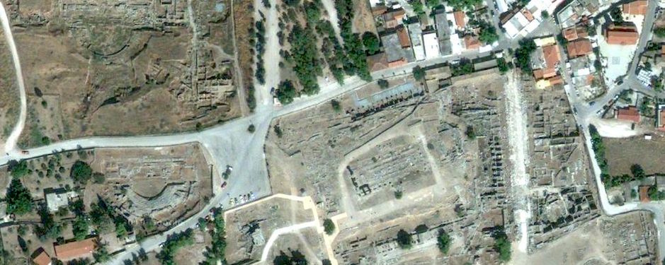
During the course of the seventeen years of the project to date (2005), the nature of the research has evolved from a fairly straightforward consideration of the location and orientation of the excavated roadways of the Roman colony, to a more complex topographical and architectural consideration of various elements of the colony, including the rural as well as the urban aspects of planning and settlement. The project now utilizes a number of methodologies, simultaneously, in the overall study of the ancient city. One aspect of the project is a regional landscape study of a portion of the Corinthia, with the city of Roman Corinth as the focus. Another aspect of the project is the effort to include information from the city of Corinth from chronological periods other than Roman, specifically Archaic and Classical Greek, Hellenistic, Late Roman, Byzantine, Frankish, Venetian, and the seventeenth through the twentieth centuries. By means of low level and high altitude air photography, as well as satellite images and some balloon photographs, the limits of the project have been greatly expanded into areas that had not been considered in the original research design. More than 120 Penn undergraduate and graduate students have been trained to date in these modern methods in the field in Corinth and in the lab in Philadelphia. Aspects of the results of the research and methodology of the project are available at the project's website.