
Since its inception, the University of Pennsylvania Museum has supported a strong program of research and excavation in the Mediterranean world. Highlights include an emergency underwater excavation of a shipwreck off Porticello, Italy, (dating between 415 and 385 B.C.); the Greek colony of Sybaris, Italy (founded around 720 B.C.); the settlement and surroundings of Vrokastro, Crete (Middle Minoan, with a reoccupation from about 1250 B.C. to the 7th century B.C.); the city and cemeteries of Kourion, Cyprus (Late Bronze Age into the Hellenistic and Roman periods); a merchant vessel shipwreck off Kyrenia, Cyprus (4th century B.C.); Gordion, Turkey, once ruled by the famed King Midas (Early Bronze Age into the Roman period); and the Extramural Sanctuary of Demeter and Persephone at Cyrene, Libya (ca. 600 B.C. until the mid third century A.D.).
The University Museum also houses one of the largest collections of Egyptian and Nubian material in the United States, with more than 42,000 items. Assembled through nearly a century of archaeological research, this collection is unusual in that a majority of the objects were obtained through archaeological investigations in Egypt. Because the museum has worked at a wide range of sites (provincial and royal cemeteries, palaces, temples, towns, sanctuaries and settlements), the collection spans ancient Egypt's entire history, from the Predynastic Period (circa 4000 B.C.) through the Greco-Roman Period and into the Coptic Period (ending in the 7th century A.D.). It also includes a large number of material categories, such as architecture, statuary, minor arts, domestic artifacts, textiles, papyri, pottery, tools, jewelry, weapons, funerary objects and human remains.
A major part of the collection, however, results from excavations sponsored by the UPM. The Museum sponsored excavations in settlements and cemeteries in Nubia; at Egypt's ancient capital city of Memphis (Mit-rahina); in the cemeteries at Dendera, Giza, Dra’ Abu el-Naga (near Thebes), and Meidum; and at the major cult center of Abydos, among others. Before originating its own excavations, the UPM contributed funding to support the work of the Egypt Exploration Fund (later Egypt Exploration Society), a British organization responsible for archaeological excavations throughout Egypt. In particular, it funded the work of Sir William M. Flinders Petrie, one of the foremost archaeologists working in Egypt at the time. As a result, the Museum obtained a significant portion of the material awarded to this project by the Egyptian government. Among the most important artifacts are the Predynastic and Early Dynastic remains, which document the earliest periods of Egyptian history and the formation of the unified state.
Recent Projects
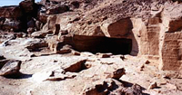
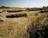
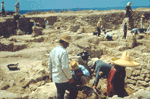
For the past 30 years, the University Museum has conducted excavations and surveys at the site of Abydos, an important town site, cemetery, and cult center for the worship of Osiris. Excavations have revealed important information about the Archaic period (3000-2625 B.C.), including the discovery of royal boat pits and the enclosure of King Khasekhemwy.
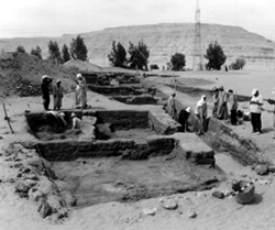
For the past 30 years, the University Museum has conducted excavations and surveys at the site of Abydos, an important town site, cemetery, and cult center for the worship of Osiris. Excavations have revealed important information about the Archaic period (3000-2625 B.C.), including the discovery of royal boat pits and the enclosure of King Khasekhemwy. Continuing projects include that of Josef Wegner at the mortuary complex and adjacent town site of Pharaoh Senwosret III (1878-1841 B.C.) and Mary Ann Pouls' excavations in the Middle Kingdom cenotaph zone, which have also uncovered a small temple of Tuthmosis III (1479-1458 B.C.).
Excavation of the newly discovered temple of Thutmose III formed an important component of the archaeological research that the North Abydos project carried out in the spring of 1997. A small Eighteenth Dynasty structure was discovered in the course of the previous season of fieldwork, and continued excavation of the site has focused on articulating the unusual architectural plan of the temple, and recording the numerous fragments of beautifully carved and painted scenes and texts which once covered its limestone walls. This research will ultimately enable the program of the temple's relief decoration to be reconstructed, and will clarify its function within the larger context of the cult of Osiris at Abydos.
In 1994 Josef Wegner (now Associate Professor, Near Eastern Languages and Civilizations; Associate Curator, Egyptian Section, University Museum) re-excavated and re-studied a severely damaged temple complex built for pharaoh Senwosret III (1878 - 1841 B.C.), with important results. The temple proper had been entirely removed in antiquity, but the new excavations located part of its outline, scratched by builders on the stone platform upon which the temple had stood. Most important of all, hundreds of decorated fragments, reflecting the temple's function and overlooked earlier, were also recovered.
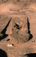
Dr. Wegner has also conducted more recent excavations at South Abydos. In 2002 magnetic resonance mapping was completed in and around the current excavation site of the mortuary complex and town of Senwosret III. The results of the magnetic survey were positive, and allowed for the identification of two important structures near the town of Senwosret III: 1) a likely administrative building which may have been the center for the local mayoral administration of the town and cult foundation of Senwosret III, and 2) a silo complex which appears to be part of the agricultural storage facilities of the town. In 2003 excavations yielded a mastaba-tomb that may be belong to a king of the 13th dynasty. This tomb includes a massive sarcophagus and burial chamber set within a superstructure of brick. Objects recovered included pieces of painted and gilded plaster that may derive from parts of the burial equipment and elegantly made alabaster vessels. The architecture and objects indicate the possible burial site for a pharaoh of early Dynasty 13 (ca. 1800 B.C.), but future work is required to make a positive identification of the tomb owner.
In an area today called "South Abydos" are remains of a tomb complex built during Egypt's Middle Kingdom by the 12th Dynasty king Khakaure-Senwosret (also called Sesostris III), who reigned ca. 1880–1850 BCE. Making use of the desert landscape, royal architects built an underground tomb for the pharaoh at the foot of the desert cliffs. Associated with this tomb was a mortuary temple and a town site, both built to maintain the afterlife cult of pharaoh Senwosret III. Anciently named Enduring-are-the-Places-of-Khakaure-true-of-voice-in-Abydos, the ruins of this expansive site offer considerable evidence on society and culture during Egypt's Middle Kingdom. Penn Museum excavations are ongoing (as part of the combined University of Pennsylvania-Yale-Institute of Fine Arts/New York University Expedition to Abydos). This work has concentrating on three principal areas: (1) the subterranean tomb of pharaoh Senwosret III; (2) the mortuary temple and associated structures dedicated to the cult of Senwosret III; and (3) the urban remains of the Middle Kingdom town at South Abydos.
The Gordion Project began in 1950 under the direction of Rodney S. Young (Curator-in-Charge, Mediterranean Section, University Museum) who subsequently directed 17 seasons of excavation. Attention concentrated on the large Phrygian Destruction Level (now dated to ca. 800 B.C.) and the subsequent rebuilding and occupations. After Young's accidental death in 1974, K. DeVries (1974-1987) and then G. K. Sams (1987-present) served as the Gordion Project Director, as analysis, conservation, and publication of excavated material progressed. In 1988-89 excavation resumed under the direction of M. M. Voigt. The goal was a detailed stratigraphic sequence of artifactual, floral, and faunal samples from the Middle Bronze age through the late Hellenistic period (ca 1500-150 B.C.), with particular attention devoted to strata documenting the Late Bronze to Early Iron Age transition. Subsequent excavations conducted in 1993-1997 focused on the development of the Phrygian city from the Middle Phrygian through Hellenistic and early Roman Imperial periods.
After further intensive survey work in the outer town by Andrew Goldman, Lisa Kealhofer launched a detailed regional survey in 1996. Conservation of materials from the R. S. Young excavations continues yearly, under the direction of G. K. Sams and Jessica Johnson, with many of these objects now on display in the newly expanded museum at Yassihüyük/Gordion. Conservation of the wooden objects found in R. S. Young's excavation of tumuli, especially the wooden furniture from the Tomb of Midas, has been carried out in Ankara under the direction of Elizabeth Simpson (Ph.D., Univ. of Pennsylvania, 1985).
This project, directed by Holly Pittman (History of Art), is currently engaged with the final publication of six seasons of excavation at the Sumerian capital of Lagash undertaken by Donald P. Hansen at the Institute of Fine Arts. This publication project has developed a fully platform for data analysis and is currently integrating with the Ur project to develop a regional database which will integrate archaeological, archival, artefactual, and remote sensing data streams. The project is currently proposing to resume excavation at the site in 2018 in conjunction with European collaborators working at Girsu and Ningin.
The Molyvoti, Thrace, Archaeological Project (MTAP), a Greek-American collaboration co-directed by Nathan Arrington (Princeton University), Marina Tasiklaki, Domna Tersopoulou. and Thomas Tartaron (Penn, Classical Studies as survey director), investigates an ancient trading port located on the Thracian Sea between ancient Abdera and Maroneia. The project, which began in 2013, aims to ascertain the identity, form, and chronology of the city on the Molyvoti Peninsula; to explore its various roles in regional communication and exchange networks; and to assess its evolving relationship with the landscape and local populations. A particular interest is the formation and evolution of an emporion (trading port) in its changing economic and cultural contexts, taking into consideration regional dynamics and constraints as well as individual agency. Excavation and survey of the city and its hinterland on the Molyvoti Peninsula—located between east and west, sea and land—promises to make a substantial contribution to our understanding of settlement, trade, politics, and society in the Archaic, Classical, Hellenistic, and Roman periods (6th century BCE to 6th century CE).
The Naxcıvan Archaeological Project, a joint American-Azerbaijani program of surveys and excavations co-directed by Lauren Ristvet (Penn, Anthropology), studies the north-eastern frontier of Greater Mesopotamia. Ongoing surveys reveal how the interaction between nomads, local centers and external empires created a unique political landscape in the Caucasus. Our work at Oglanqala, the largest archaeological site in Naxcıvan, Azerbaijan, analyzes economic and cultural imperialism at this fortress during the Achaemenid Persian Empire (550–330 BCE). Current excavations focus on unearthing the ancient imperial palace, where some of the first evidence of writing in Azerbaijan was found and exploring a neighborhood in order to understand how imperial policies affected everyday life. Naxcıvan is one of the first projects in the least explored area of the Near East.
As the flagship project of the North American Archaeology Lab at Penn, the Smith Creek Archaeological Project (SCAP) was launched in 2015. The project focuses excavations on the Smith Creek site in Wilkinson County, Mississippi, which consists of three earthen mounds surrounding an open plaza. After an early occupation by the Early Woodland Tchefuncte culture (ca. 200 BC), the mounds were constructed primarily by the Late Woodland Coles Creek culture (AD 700 – 1200). Heavy occupation continued into the subsequent Mississippian Plaquemine period (AD 1200 – 1350). The transition from Coles Creek to Plaquemine marks a period of major transition in the American South—from the construction of smaller burial mounds to large platform mound-and-plaza centers, from largely egalitarian to hierarchical sociopolitical organization, and from hunting and gathering to corn agriculture. SCAP explores the relationship between these important changes through archaeological excavation and analysis of the recovered materials. Please see Dr. Kassabaum’s homepage for more information.
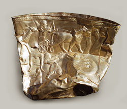
In the 1920's, the Royal Cemetery of Ur excavations became one of the great technical achievements of Middle Eastern archaeology, and now represent one of the most spectacular discoveries in ancient Mesopotamia. Deep within the site lay the tombs of the mid-3rd millennium B.C. kings and queens of the city of Ur, famed in the Bible as the home of Biblical patriarch, Abraham.
The tombs date to the period known as Early Dynastic IIIA (2600-2500 B.C.), a high point in the history of Sumerian culture.
The renowned excavator of the cemetery was British archaeologist Sir Leonard Woolley, who directed a joint expedition of the University of Pennsylvania Museum and the British Museum. The team uncovered some 1800 burials, 16 of which Woolley classified as royal based on their distinctive form, their wealth, and the fact that they contained the burials of household servants, male and female, along with clearly high-ranking personages.
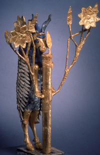
As provided by Iraq's first Antiquities Law, established in 1922, the artifacts were divided between the excavators and the host country. They are currently housed in the British Museum, the University of Pennsylvania Museum, and the Iraq Museum in Baghdad. Some of the more striking and important artifacts from the tombs, now in the University Museum, include a large wooden lyre with a gold and lapis lazuli bull's head; a silver-covered, boat-shaped lyre with a statuette of a rampant stag; and the world-renowned "Ram-in-the-Thicket," a statuette of a goat standing and nibbling the leaves of a tree or bush.
In 2016, Penn archaeologists again returned to Ur, under the direction of AAMW alum Dr. Brad Hafford, (initially alongside archaeologists at SUNY Stony Brook), to investigate a series of houses. Beginning in 2024, the focus of the project switched to conservation and community engagement under the joint direction of Dr. Lauren Ristvet and Dr. Salam al-Kuntar (Rutgers).
Earlier Projects
The University Museum collections include artifacts from five seasons of survey and excavation in the Baq'ah Valley (between 1977 and 1987), nine miles northwest of Amman, Jordan. Dr. Patrick McGovern Senior Research Scientist in MASCA (Museum Applied Science Center for Archaeology) directed excavation and survey at several different tells and burial caves. The artifacts discovered ranged from the early Bronze Age through the Mamluk period, and among the most significant were a large late Bronze Age cult building and one of the largest tombs from the early Iron Age (1230-1050 B.C.E.) to have been excavated in this area.
In 1989, under the co-directorship of David P. Silverman (Curator-in-Charge, Egyptian Section), the University Museum began epigraphic work at the tombs of the nomarchs (local governors) at the site of Bersheh, a major provincial cemetery of the First Intermediate Period and Middle Kingdom (2130-1630 B.C.). A joint expedition with the Museum of Fine Arts, Boston, and the University of Leiden focused on the tomb of the nomarch Nehri (Tomb 7). The results of this season's works were published in Bersheh Reports I.
 The site of Beth Shean (modern Beisan) is 17 miles (27 km) south of the Sea of Galilee, at the strategic junction of the Harod and Jordan Valleys, and the site was almost continuously occupied from the Chalcolithic period to the present. Between 1921 and 1933, excavations conducted under the auspices of the University Museum uncovered eighteen city levels dating from the late Neolithic period (4500 B.C.E.) through the 12th century C.E. At the time of the conquest, according to the Bible, Beth Shean was one of the cities from which the Israelites did not rout the Canaanites (Joshua 17:11; Judges 1.27). It was also named as the city onto whose walls the Philistines "fastened" the body of Saul and those of his sons (I Samuel 31:10). The project at Beth Shean was one of the largest excavations of its time. Among the most impressive finds were those from the late Bronze to early Iron Age (1400 to 1150 B.C.E.) when it was an Egyptian administrative center and garrison. The highlight of the excavations was the discovery of a series of five Canaanite and hybrid Egypto-Canaanite temples. Burials contemporary with these city levels were excavated in the north cemetery.
The Black Sea Trade Project is an interdisciplinary study of trade systems in the Black Sea over the past 5,000 years and their effects on local cultures and economies. The project focuses on the hinterland and port of Sinop (ancient Sinope), an important Greek and Roman colony at the midpoint of the Turkish Black Sea coast.
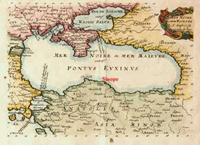
The Black Sea Trade Project is an interdisciplinary study of trade systems in the Black Sea over the past 5,000 years and their effects on local cultures and economies. The project focuses on the hinterland and port of Sinop (ancient Sinope), an important Greek and Roman colony at the midpoint of the Turkish Black Sea coast. The long-term goal is to document the development of Sinop and its hinterland from mountaintop to ocean bottom using techniques that will disturb the archaeological record as little as possible. Directed by Fredrik Hiebert (Research Associate, University Museum) and Owen Doonan (California State University, Northridge), the project includes: survey programs on land and under water; geomorphological research; art historical documentation of under-studied material held in museum collections; comprehensive study of literary, historical, and epigraphic evidence; and selected emergency excavation of sites threatened by modern building. So far about 180 sites have been documented in the Sinop region, each of which has been pinpointed on 1:25,000 topographic maps provided by the Turkish government using a Global Positioning System (GPS).
Since 1988 a research team known as the Corinth Computer Project led by Dr. David Gilman Romano (Senior Research Scientist) from the Mediterranean Section of the University of Pennsylvania Museum of Archaeology and Anthropology has been involved in making a computerized architectural and topographical survey of the Roman colony of Corinth.
Since 1988 a research team known as the Corinth Computer Project led by Dr. David Gilman Romano (Senior Research Scientist) from the Mediterranean Section of the University of Pennsylvania Museum of Archaeology and Anthropology has been involved in making a computerized architectural and topographical survey of the Roman colony of Corinth.
The field work (1988-1997) was carried out under the auspices of the Corinth Excavations of the American School of Classical Studies at Athens, Dr. Charles K. Williams II, Director. The original objectives of the project were to study the nature of the city planning process during the Roman period at Corinth; to gain a more precise idea of the order of accuracy of the Roman surveyor; and to create a highly accurate computer generated map of the ancient city whereby one could discriminate between and study the successive chronological phases of the city's development.
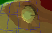
During the course of the seventeen years of the project to date (2005), the nature of the research has evolved from a fairly straightforward consideration of the location and orientation of the excavated roadways of the Roman colony, to a more complex topographical and architectural consideration of various elements of the colony, including the rural as well as the urban aspects of planning and settlement. The project now utilizes a number of methodologies, simultaneously, in the overall study of the ancient city. One aspect of the project is a regional landscape study of a portion of the Corinthia, with the city of Roman Corinth as the focus. Another aspect of the project is the effort to include information from the city of Corinth from chronological periods other than Roman, specifically Archaic and Classical Greek, Hellenistic, Late Roman, Byzantine, Frankish, Venetian, and the seventeenth through the twentieth centuries. By means of low level and high altitude air photography, as well as satellite images and some balloon photographs, the limits of the project have been greatly expanded into areas that had not been considered in the original research design. More than 120 Penn undergraduate and graduate students have been trained to date in these modern methods in the field in Corinth and in the lab in Philadelphia. Aspects of the results of the research and methodology of the project are available at the project's website.
Located at the crest of the Cyrenaican (Libyan) coastal plateau, Cyrene was colonized by Greeks from the island of Therea around 630 B.C. Its population was gradually augmented by the arrival of other Greeks after 600, and by the century's end it had become the largest and richest of North Africa's Greek colonies. Excavation of its Intramural Sanctuary of Demeter and Persephone began in 1969 under the sponsorship of the University of Michigan, and was continued by the University Museum between 1973 and 1981 under the direction of Donald White (Curator Emeritus, Mediterranean Section).
The Sanctuary grounds rise on terraces across the sharply rising slope of a plunging ravine or wadi south of the walled city. Its complex walled remains span some 850 years of religious activity, dating from ca. 600 B.C. until the mid third century A.D. During this time a large amount of votive material accumulated in the Sanctuary: stone sculpture, pottery, lamps, coinage, personal jewelry, glass, inscriptions, and bronze and terracotta figurines. The site suffered a crippling earthquake in A.D. 262, and then again in 365 when it passed out of use after being vandalized by the local Christian population. The city eventually fell to the Arabs in A.D. 643. To date, seven volumes on the results of the excavations have been published as University of Pennsylvania monographs: two by White, and the remaining five by a team of American, Australian, and British scholars. Four additional volumes are pending, including White’s study of the Sanctuary’s final two-hundred fifty years of architectural and religious development.
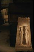
The University Museum participated in work at the site of Dendereh, an important cemetery site spanning the Old through Middle Kingdoms (2625-1630 B.C.). Egyptian Section curator Clarence Fisher excavated the site from 1915-1918, continuing the work begun by Charles Rosher and Flinders Petrie at the end of the nineteenth century. In addition to furnishing significant information on the history, culture and funerary practices of this critical transitional period in Egyptian civilization, the Dendereh excavations have provided the Museum with a wealth of important artifacts, including ceramics and other funerary offerings, inscribed stelae, and a variety of architectural elements from the tombs.
From 1921-1923 the site of Dra Abu el-Naga was excavated by Clarence Fisher, one of the early curators of the University Museum's Egyptian Section. The site was an important non-royal cemetery near Deir el Bahri in western Thebes, near the modern Egyptian city of Luxor. Fisher's excavations included work in the tombs of New Kingdom officials and the mortuary complex of the 18th Dynasty king Amenhotep I and his wife Nefertari. Beginning in 1967, Lanny Bell continued work at the site, concentrating on the epigraphic recording and conservation of the decorated rock-cut tombs of Dynasty 19 (1292-1190 B.C.). The excavations at Dra Abu el-Naga provided significant artifacts for the University Museum, including statuary, pottery, funerary furnishings, and painted reliefs.
The site of Gibeon was excavated by James B. Pritchard, the first curator of the Biblical Archaeology section of the University Museum. Gibeon, now the modern Arab village of el-Jib, was first occupied in the Middle Bronze Age I as evidenced mainly by its cemetery. In the Early Iron Age, a massive city wall was built around the mound and a huge cylindrical pool for fresh water, reached by a spiraling stair of 79 steps, was excavated in the bedrock. The city reached its peak in the 7th century B.C.E. when the entire mound was covered with buildings, and the Gibeonites produced and traded large quantities of wine. Altogether, 63 rock-cut storage cellars for wine were excavated by Dr. Pritchard.
Penn excavations at Giza began in 1915 under the direction of University Museum Egyptian Section Curator Clarence Fisher and focused on the area known as the "minor cemetery." This excavation produced important information on the arrangement of Old Kingdom (2625-2130 B.C.) mastaba tombs and the mortuary cults of their owners. In the 1970's the University Museum renewed work at Giza as a sponsor of the Giza Mastabas Project, under the direction of David O'Connor, Egyptian Section Curator-in-Charge, and William K. Simpson. This work has resulted in several volumes providing information about tombs in the Giza Necropolis.
In 2004 Prof. Brian Rose (Curator-in-Charge, Mediterranean Section, University Museum; AAMW Chair) began a new multi-year project, The Granicus River Valley Archaeological Survey Project, focused on an area of northwestern Turkey that was controlled by both Greeks and Persians during the first millennium B.C. Looting there has become increasingly rampant due to the gold and silver objects still preserved in many of the tombs, and the new survey represents the first attempt to record and map both the settlements and burial mounds in this region.
The majority of the tombs are being explored with remote sensing (magnetometry and/or radar), while geophysical investigations (core-sampling) are being conducted around the Granicus River, where Alexander the Great launched a major battle against the Persian army in 334 B.C. Most of the tombs date from the late Archaic to the early Hellenistic period, and were set up by wealthy Anatolians associated with the Persian governor (or satrap) at the regional capital of Daskyleion. One of them yielded the earliest stone sarcophagus with figural scenes ever to have been found in the eastern Mediterranean, and the decoration features the murder of Polyxena, daughter of Priam. Another sarcophagus within the same tomb contained the body of a child surrounded by gold jewellery and silver symposium implements. A third sarcophagus (ca. 400-375 B.C.), with its paint still intact, contains a biographical narrative of the deceased, showing him victorious on the battlefield and in a boar hunt. These are Graeco-Persian products, carved primarily by Greek artists for Persian patrons.
This project focuses on excavation of the sites of Konar Sandal South and North near the town of Jiroft in the valley of the Halil river in south-central Iran. The area was first revealed by extensive looting in 2000 and 2001, and Iranian archaeologists began excavation at the Bronze Age sites in the valley of the Halil Rud under the direction of Youssef Madjidzadeh in 2003. Dr. Holly Pittman (Professor, History of Art; Curator, Near Eastern Section, University Museum), together with students from History of Art, Anthropology, and AAMW, participated in several seasons of excavations of the two mounds, as well as the exploration and survey of the region. The preliminary results of these early seasons of excavation have revealed a hitherto unknown civilization of the early Bronze Age that interacted with societies in Mesopotamia, the Indus valley, and Central Asia. Most interesting among the finds are more than 150 impressions of cylinder and stamp seals used in the administration of the region. One of the brick tiles is inscribed with linear Elamite.
The project takes its name from the site of Tepe Hasanlu, located near the modern Iranian city of Mahabad. It is the largest site in the Gadar River Valley, which runs from the Zagros mountains on the west to the marshy southern shore of Lake Urmia at the east. The valley provides a direct route from the border of Assyria on the west to highland Iran on the east. Occupation in the region extends from the sixth millennium B.C. through ca. 800 B.C., when a violent attack, possibly led by an army from the neighboring Urartu kingdom, destroyed the citadel.
The excavations of Hasanlu ran from 1957 through 1977, and were sponsored by the University Museum, the Archaeological Service of Iran, and the Metropolitan Museum of Art, with the overall direction provided by Robert H. Dyson, Jr., former Director of the Museum and Curator Emeritus, Near Eastern Section. The Hasanlu Project involved from the outset the study of more than just the main site, and preliminary soundings and excavations were also carried out at neighboring sites, including Hajji Firuz, Dalma Tepe, Pisdeli Tepe, Dinkha Tepe, Agrab Tepe and Qalatgah among others. The early Iron Age levels of Hasanlu and other neighboring sites excavated by the Hasanlu Project played a central role in defining the Iron Age chronology for Western Iran.
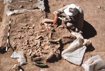
The syncretistic nature of the architecture and artifact assemblages at Hasanlu may be understood by recognizing its location on trade routes leading from the kingdom of Urartu in the north, from Assyria and Syria to the west, and from Mannea and Media to the southeast. These trade routes facilitated the movement to this area of materials, objects, craftsmen, teachers, and officials from neighboring centers. Among the discoveries in the destruction level, which contained the remains of 240 inhabitants, was a golden beaker, now in the National Museum of Iran, which features repoussé decoration of mythological scenes.
Between 1996 and 2000 joint team from the University of Pennsylvania, the American Academy in Rome, and the Institut National du Patrimoine conducted a survey of the Island of Jerba, under the direction of Dr. Renata Holod (History of Art; Curator, Near Eastern Section, University Museum), Dr. Elizabeth Fentress (Research Associate, Mediterranean Section, University Museum), and Dr. Ali Drine. The survey, carried out by transects running north-south across the island, revealed over 400 sites, giving a clear picture of the development of settlement between the fifth century B.C. and the 19th century. It revealed precocious agricultural settlement, fairly intensive trade with central Italy, and a strong presence of villas by the second century B.C.; a decline in sites in the fifth century; and a gradual strengthening of the settlement from the ninth century A.D. onward. This fairly coarse-grained image was further refined by intensive, gridded survey of the city-sites, Būrgū and Meninx, and of an 18th century estate, Gish’iyyīn; by geophysical survey at Meninx; and by excavation at a number of sites: the Punic and Roman city of Meninx, the late Roman fortlet at Tala, early mosques at Jami J Gmīr and Jami J Zāyid, and a medieval house at Jami J Zāyid. The publication is due in 2006 as a supplement to the Journal of Roman Studies.
The survey formed the basis of the dissertation of Thomas Morton (History of Art, Ph.D, 2003), who examined the forum of Meninx, on the southeastern coast of Jerba. The architecture was examined through the lens of Meninx's famed purple dye production, which made it one of the most prominent cities in Roman North Africa.
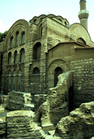
The Kalenderhane mosque in Istanbul is located in the center of the old city at the eastern end of the Valens Aqueduct, and was excavated and restored by Prof. Cecil L. Striker (Penn, History of Art) and Prof. Dogan Kuban (Istanbul Technical University), in collaboration with the Dumbarton Oaks Center for Byzantine Studies between 1966 and 1978.
The Kalenderhane mosque in Istanbul is located in the center of the old city at the eastern end of the Valens Aqueduct, and was excavated and restored by Prof. Cecil L. Striker (Penn, History of Art) and Prof. Dogan Kuban (Istanbul Technical University), in collaboration with the Dumbarton Oaks Center for Byzantine Studies between 1966 and 1978.
Their study revealed that the existing building was originally the church of the Kyriotissa Monastery and was built in the years 1197-1204, replacing and incorporating the remains of seventh and sixth century churches and a small Roman bath built around 400 A.D. A wall mosaic found in the sixth century church depicts the Presentation of the Christ Child in the Temple, and is the only wall mosaic to have survived from the pre-Iconoclast era in Constantinople.
Fragmentary frescos depicting the life of St. Francis of Assisi, found in a side chapel and painted around 1250 during the occupation of Constantinople by the Fourth Crusade, are the earliest surviving mural paintings of the life of the saint. The mosaic and frescos are on display in the Istanbul Archaeological Museum, and the building was restored for use again as a mosque.
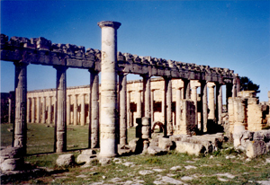
Located on the southwest coast of Cyprus, Kourion was one of several independent kingdoms of ancient Cyprus. It was settled as early as the late Bronze Age (14th century BC.), but most of the visible remains at the site belong to the Hellenistic and Roman periods. The University Museum began excavations at Kourion in 1934 under the direction of Bert Hodge Hill, and work continued until 1941 when World War II intervened. Excavations were resumed in 1948 under the direction of George McFadden and continued until his death in 1953. These excavations uncovered extensive cemetery areas of the late Bronze and early Iron Ages, as well as parts of the Greek and Roman city. A major focus of the Museum's work, however, was the excavations of the Sanctuary of Apollo Hylates, about 3 kilometers west of the main city center. Here worship of Apollo began as early as the eight century B.C.
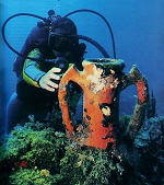
An Underwater Archaeology Section of the University Museum was founded in 1960, overseen by George F. Bass, a former curator of the Mediterranean Section and one of the pioneers in the science of underwater archaeology. The first Underwater Archaeology project was a late Bronze Age shipwreck at Cape Gelidonya, off the southwest coast of Turkey. In 1968 underwater excavations were carried out by the Museum, this time off the north coast of Cyprus, near Kyrenia. With the cooperation of the Department of Antiquities of Cyprus, and under the direction of Michael Katzev, these excavations uncovered a fourth century B.C. Greek merchant vessel that sank in the early third century B.C. The vessel was carrying a cargo of hundreds of amphorae, some of which contained almonds. Twenty-nine millstones, probably used as ballast, were also recovered, as well as pottery from the ship's cabin and coins that helped to date the wreck.
The palaeobotanical project at Lake Nemi is part of a larger multi-disciplinary excavation and research project at a Roman villa and at the Sanctuary of Diana on the shores of Lake Nemi, in the Alban Hills south of Rome. In 2001 and 2002, with an invitation from the Nordic Institutes in Rome and the Soprintendenza Archeologica per il Lazio, Dr.
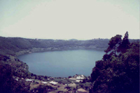
The palaeobotanical project at Lake Nemi is part of a larger multi-disciplinary excavation and research project at a Roman villa and at the Sanctuary of Diana on the shores of Lake Nemi, in the Alban Hills south of Rome. In 2001 and 2002, with an invitation from the Nordic Institutes in Rome and the Soprintendenza Archeologica per il Lazio, Dr. Irene Bald Romano, Research Associate of the Mediterranean Section of the Museum, organized a team of archaeologists specializing in the excavation of ancient gardens, as well as soil scientists, remote sensing specialists, and palaeobotanists to excavate and study the garden areas of a large Roman villa. The villa, built in the 1st c. BCE and destroyed in the 2nd c. CE, is probably that which is described in ancient sources as a country home of Julius Caesar, later inherited by the imperial family. The team was able to identify some of the garden areas of the villa, pinpoint garden features, and identify aspects of the wider botanical landscape, as well as individual cultivated species in the villa area such as grapes, wheats, barley, legumes, and olives. In addition, the team was invited to explore an area of the nearby Sanctuary of Diana Nemorensis in which there is evidence for a grove. In the coming year the team will return to the sanctuary to excavate and study a series of planting pits. Dr. Romano has also initiated a collaborative palynology (study of pollen) project with the Rijksuniversiteit Groningen in the Netherlands to analyze sediment cores taken from Lake Nemi. The goal is to augment the information from the land excavation and provide a diachronic picture of the palaeobotanical environment in the area around Lake Nemi.
The royal city and palace complex of King Amenhotep III (1391-1353 B.C.), one of the longest ruling pharaohs of the 18th Dynasty, was excavated between 1971 and 1977 by University Museum Egyptian Section Curator David O'Connor and Cambridge University Egyptologist Barry Kemp. The site consists of a number of residential and ceremonial structures, including a temple to Amun and at least four palaces. To the east of the complex stood a vast artificial harbor and canal, while the earth removed in antiquity during the excavation of the harbor was used to create a series of man-made hills along the southwestern shore. The artificial harbor is the largest known in ancient Egypt.
The excavations of the University Museum at Marsa Matruh on Bates Island, on the north coast of Egypt's western desert, were conducted by Prof. Donald White (Curator Emeritus, University Museum) between 1985 and 1989. Excavations uncovered a site located on a small island positioned at the end of a protected salt water lagoon.
The excavations of the University Museum at Marsa Matruh on Bates Island, on the north coast of Egypt's western desert, were conducted by Prof. Donald White (Curator Emeritus, University Museum) between 1985 and 1989. Excavations uncovered a site located on a small island positioned at the end of a protected salt water lagoon. During the late Bronze Age its facilities were used during the non-winter months by Aegean mariners to break their voyages between Crete and the southeastern Mediterranean. In addition to modest living quarters and storerooms, the island was equipped with a shop for metalworking, in which simple tools were manufactured for exchange with the local Libyan population who provided the island mariners with water, food, fuel and ostrich egg shells. The pottery wares indicate that the settlement had links to Cyprus, the Aegean, and Canaan, in addition to Egypt and their Libyan neighbors.
The results of the excavations have recently been published in two volumes by INSTAP press. Volume one provide an overview of the area and its recent excavations, the late Bronze Age and historical period occupations, and an introduction to the island’s environmental morphology and history. Volume two provides separate studies of the site’s late Bronze Age and Greco-Roman through Islamic pottery, its metal and lithic tools, its faunal remains, and its archaeobotanical history.
Memphis (now called Mit Rahineh) was the capital city of Egypt during the Old Kingdom (2625-2130 B.C.) and remained an important administrative and religious center throughout Egyptian history. The site of Memphis was sacred to the god Ptah, his consort Sekhmet and the third member of the Memphite Triad, Nefertem. Egyptian Section Curator Clarence Fisher excavated at Memphis for 8 years (1915-1923), during which he discovered the ceremonial palace of the New Kingdom pharaoh Merenptah (1213-1204 B.C.) as well as an associated urban area; a series of later settlements; and a temple precinct dedicated to Ptah. Much of the material excavated during these seasons, including substantial portions of the palace, is now in the University Museum. Under Rudolf Anthes, the Museum returned to the site of Memphis during the years 1950-1962 and excavations were carried out at the temple of Ptah.
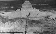
The site of Meydum, one of the most important royal and non-royal cemeteries of the Old Kingdom (2625-2130 B.C.), was excavated from 1929-1931 under the direction of Egyptian Section Curator Alan Rowe. His work was a continuation of that begun by Flinders Petrie at the pyramid of Meydum and the surrounding 3rd and 4th Dynasty (2675-2500 B.C.) mastabas. Rowe's excavations also uncovered later burials dating from the Middle Kingdom (1980-1630 B.C.) to the Graeco-Roman Period (332 B.C.-A.D. 642).
Minturnae lies 65 kilometers northwest of Naples, where the Via Appia crosses the Garigliano (ancient Liris) River on the border between Latium and Campania. Originally inhabited by Italic tribesmen called the Aurunci, Minturane was conquered by the Romans in 313 B.C. The site soon grew to a respectable size, in part because the Via Appia ran directly alongside it, but it was badly damaged by fires toward the end of the Republic. Recolonized by Augustus, Minturnae enjoyed a long existence until its final abandonment about A.D. 590. The site was excavated under the auspices of the University Museum by Jothan Johnson between 1931 and 1933, and the Museum received part of the discoveries by agreement with the Italian Department of Antiquities. Architectural terracottas make up the Museum's most exceptional finds from Minturnae. Although typical of central and northern Italo-Etruscan buildings, such decorations are rarely found in museums outside of Italy. The once colorfully painted revetments are part of a native Italic crafts tradition. Conservative traditionalists like Cato the Elder (243-149 B.C.) praised the technique, but such terracottas eventually lost their appeal and disappeared. Minturnae marks the furthest south that they have been found.
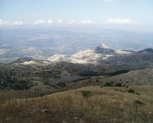
The Mt. Lykaion Excavation and Survey Project is an international, multidisciplinary, scientific investigation at the sanctuary of Zeus on Mt. Lykaion, Arcadia. According to ancient authors, this sanctuary was famous in antiquity as the site of Pan-Arcadian and Pan-Hellenic athletic contests in honor of Zeus, and for an impressive open-air altar where human sacrifice reportedly took place.
There were limited excavations at Mt. Lykaion over 100 years ago in which various features were uncovered, including the mound of ashes on the southern peak of the mountain, 1380 m. asl, the temenos, a hippodrome, stadium, bathhouse, fountains, and a stoa. Although Dr. D. G. Romano conducted a computerized architectural and topographical survey at the site in 1996, thereby laying the groundwork for future work, the current project represents the first comprehensive scientific exploration of this site.
The Mt. Lykaion Project is co-directed by Dr. D. G. Romano, University of Pennsylvania Museum, and Dr. M. Voyatzis, University of Arizona (Penn, B.A. Classical Studies '78), and is being conducted under the auspices of the American School of Classical Studies in Athens, in collaboration with the Greek Archaeological Service. During the summers of 2004 and 2005, preliminary work was initiated, including clearing the site, an architectural survey of all above-ground monuments and buildings, and topographical, geological, and geophysical surveys.
The project is utilizing the latest scientific techniques, including remote sensing (magnetometry, resisitivity, ground penetrating radar), digital cartography, and GIS, including low and high level historic photographic analysis, satellite imagery, and topographical map analysis. During the next three seasons, 2006-2008, archaeological excavations will be conducted at targeted areas of the site, with specialty teams from various disciplines assisting with soil, micro-morphological, osteological and palaeobotanical analysis, and historical and epigraphical studies.
Some of the main goals of the project are the following: to learn about the origin of the cult of Zeus at Mt. Lykaion; to elucidate the social position and cult practices of the pilgrims who traveled to the site as well as the athletes who participated in the contests; to study the relationship of this sanctuary to that of Zeus at Olympia, just 17 miles distant; to determine whether the site of the sanctuary of Zeus was chosen because of the geology and/or geography of the region; to explore how the sanctuary was related to the Arcadian towns that supported it; to establish an archaeological park 300 square kilometers in area.
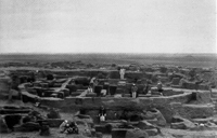
The University of Pennsylvania Museum has a long history of field work in the Middle East, beginning with the late 19th century excavations at Nippur, early Mesopotamia’s pre-eminent religious center. Nippur is located approximately 100 miles south of Baghdad, and the mound there is 60 ft. high and nearly a mile in length. The Museum's excavations at Nippur were the first American archaeological project in that part of the world.
One of the largest and longest-lived cities in Mesopotamia, Nippur was occupied before the 6th millennium BCE and habitation continued until about A.D. 800. The site functioned as a pilgrimage center, with building programs sponsored by the Babylonian and Assyrian kings, among others. Thousands of clay tablets in Sumerian and Akkadian have also been found there, including sections of the Epic of Gilgamesh and stories of the creation of mankind. The University Museum first excavated Nippur from 1888 to 1900, and co-sponsored later excavations there with the Oriental Institute, Chicago, from 1949 to 1951.
The University Museum houses about half the material excavated at Nippur in the late 19th century, probably the largest such collection in the world and certainly the largest in the United States. The collection contains approximately 5,200 pieces, including pottery and glass vessels; metal weapons and jewelry; stone beads, cylinder seals and weights; and clay plaques, loom weights, and cuneiform tablets. The seven Nippur coffins in the Museum's collection illustrate changing burial practices both at the site and more generally in southern Mesopotamia over a period of about 1000 years.
The University Museum has one of the largest collections of Nubian material in the United States, due in part to its excavations at sites in Lower Nubia such as Shablul, Areika, Karanog, Aniba and Buhen under the direction of David Randall MacIver and Sir Leonard Woolley during the years 1907-1910. In addition, the Museum participated in salvage campaigns at the sites of Toshka and Arminna during the 1960's in an effort to excavate sites that would be flooded by the construction of the Aswan High Dam. Materials in the Museum's collection span a period from prehistory through the Christian era.
Dendrochronology, or tree-ring dating, was introduced into the eastern Mediterranean region for the systematic study of ancient monuments and sites by Prof. Peter Kuniholm (Classical Archaeology, Cornell University; Ph.D. Penn, 1977) in the early 1970's. He was joined shortly thereafter as collaborator by Prof. Cecil L. Striker (Penn, History of Art), who assumed responsibility for the post-Classical, and especially the Byzantine buildings. They worked together in Turkey, Greece, and the former Yugoslavia until 1988. Thereafter, Prof. Striker continued with his own project, concentrating on the dendrochronology of Byzantine and medieval architecture in Greece, the former Yugoslavia, and Albania, and including an eight-year long study of the Heptapyrgion Castle crowning the acropolis of Thessaloniki, Greece.
The Mugello Valley Archaeological Project and Poggio Colla Field School center on the excavation of Poggio Colla, an Etruscan settlement site in the Mugello near the modern town of Vicchio, about twenty miles northeast of Florence, Italy. The project is co-directed by Professor P. Gregory Warden (Associate Dean, Meadows School of the Arts, Southern Methodist University; Research Consultant, Mediterranean Section, University Museum), and by Professor Michael L. Thomas (Tufts University). Sponsoring institutions include the Meadows School of the Arts at Southern Methodist University, Franklin and Marshall College, and the University of Pennsylvania Museum of Archaeology and Anthropology.
Poggio Colla was first excavated from 1968 to 1972 by Dr. Francesco Nicosia, the former Superintendent for the Archaeology of Tuscany. With Dr. Nicosia's permission and encouragement, the Mugello Valley Archaeological Project continued excavation in 1995. The research design of the project combines stratigraphic excavation with land survey and geophysical prospection to form an interdisciplinary regional landscape analysis of Poggio Colla and the surrounding area. Twenty years of fieldwork are planned followed by a series of comprehensive multi-authored reports.

In 1969 a sunken Greek ship had been discovered and ransacked by looters in the Straits of Messina near the village of Porticello. Shortly thereafter the University Museum was asked by the Antiquities Department of Calabria to undertake an emergency underwater excavation of the shipwreck, which yielded transport amphorae from a variety of sites as well as fragments of bronze statues. This merchant vessel, probably of Greek origin, sank or was scuttled between 415 and 385 B.C.
Clark Erickson, co-director (Penn, Anthropology), writes:
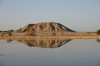
Recently documented monumental earthworks throughout the region of Western Amazonia provide important evidence of an advanced pre-Columbian civilization. Traditionally, the archaeologists have considered the vast Amazon region of South America to be a cultural backwater compared to the better-known civilizations that developed in the Americas. Scholars stress the limitations of tropical environments and lack of critical technological innovations to sustain large dense populations, intensive agriculture, monumental architecture, urban centers, and complex forms of society: the foundations of any civilization and complex societies. In recent years, the documentation of raised field agriculture, anthropogenic (human created) black earth, managed forests, hydraulic engineering, and dense large settlements for several regions of the Amazon has questioned traditional assumptions about lack of cultural development.
In collaboration with a small team of Bolivian archaeologists during 2007 and 2008, I documented over one hundred examples of a fascinating form of monumental earthworks called ring ditches or geoglyphs. The ditches and embankments encircle areas of several acres to nearly a square mile. Some earthworks are precisely constructed in geometric patterns (circles, ellipses, and squares) that suggest a clear concern for landscape design, appearance, and aesthetics. Deep ditches of up to 12 feet deep and 20 feet wide suggest tens of thousands of cubic yards of earth moved during their construction. Various hypotheses are presented for the functions of earthworks based on forms and associations. The existence of monumental works of such magnitude and density throughout Western Amazonia requires a reassessment of the prehistory of the region and the ability of native peoples to transform their landscapes at a massive scale.
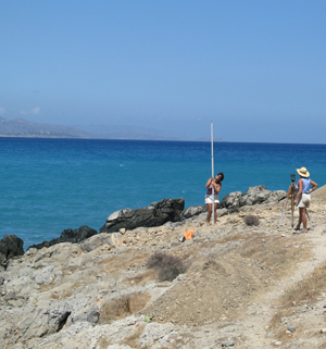
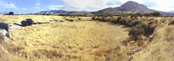
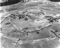
Exploration of the west-central portion of the Gulf of Mirabello coast, eastern Crete, began in 1910 and 1912 when Edith Hall of the University of Pennsylvania Museum began an excavation of the settlement and cemeteries of Vrokastro, a Bronze Age and Early Iron Age refuge settlement on a mountain peak near the coast. This excavation was followed in 1912 by a brief two-week excavation at the coastal site of Priniatikos Pyrgos, which revealed part of a large Early to Late Bronze Age harbor settlement on this small coastal promontory. The historical settlement of this coastal site was represented by abundant Roman pottery.
The Vrokastro Survey Project (Vrokastro Reports vols. 1-3, 2002-5) provided the framework for further exploration of this coastal ‘gateway’ community and emporium through analysis of the settlement systems and environment of the region, and the Istron Geoarchaeological Project (2002-6) has investigated the coastal environment of Priniatikos Pyrgos. Remote sensing conducted on the site indicated the presence of a well-preserved industrial area and settlement that spans millennia. Excavation of Priniatikos Pyrgos began in 2005, with the cooperation of the local Greek Department of Archaeology. Barbara J. Hayden, Senior Research Scientist in the Mediterranean Section of the University of Pennsylvania Museum, is directing this excavation. This project includes exploration of the history, trade networks, regional significance, and manufacturing base of this primary coastal site.
Excavation in 2005 revealed the presence of two Bronze Age pottery kilns and evidence for metalworking and ceramic and glass production in the Greek and Roman periods; a Minoan workshop area; and part of an extensive Greek and Roman/Byzantine settlement built over earlier well-preserved Bronze Age structures. The distribution of ceramics manufactured at this site can be documented through the presence of a rock temper (granodiorite) in the clay, this derived from the unique geology of the region. This ‘signature’ in the clay of vases manufactured at the site makes it possible to reconstruct the development and extent of maritime trade from Priniatikos Pyrgos in the prehistoric and historical periods.
Exploration of Priniatikos Pyrgos, the primary coastal settlement and industrial site of the west-central Gulf of Mirabello region, will result in a deeper understanding of prehistoric and historical periods in eastern Crete and interaction with other regions of Crete and the Aegean. This will be accompanied by new data concerning the development of technologies and their economic and political implications for eastern Crete and the southeastern Mediterranean.
The Roman Peasant Project, co-directed by Kimberly Bowes and Campbell Grey (Penn, Classical Studies), seeks to uncover the lived experience of the peasantry in the Roman period: their diet, economic activities, and social networks. We exploit a combination of field survey, geophysical exploration and targeted, rescue-style excavation, and place these results alongside evidence gleaned from historical, zoo-archaeological, archaeo-botanical and geological sources. Our aim is to produce 'thick descriptions' of the lives of the poorest rural inhabitants of this world, who formed perhaps as much as 90% of the population of the Mediterranean in antiquity.
Since 1992 the University Museum has been conducting a joint project with the Museum of Fine Arts, Boston in the area of the Teti Pyramid Cemetery. Headed by David Silverman, Egyptian Section Curator-in-Charge, and Rita Freed, this epigraphic project has relocated the Middle Kingdom (1980-1630 B.C.) burial chambers of the officials, Ihy, Hetep, Sekhwesket, and Sahathoripi. In addition to the investigations in these Middle Kingdom tomb chapels, the team has also focused on the 6th Dynasty (2350-2170 B.C.) tomb of Mereruka, recording the inscriptions in the rooms dedicated to his son, Meriteti. In its last season, it carried out a survey and mapping project of the area surrounding the Teti Pyramid Cemetery, and an archaeological surface survey to the south of the pyramid.
Between 1968 and 1974, Dr. James Pritchard directed four seasons of excavations at Sarepta (modern Sarafand), where the Bible locates King Solomon's bronze works.. This important Phoenician port city flourished from its foundation in about 1600 B.C.E, through the Byzanitne era. and is the one city in the heartland of Phoenicia that has been thoroughly studied following excavation. a shrine at Sarepta in Phoenicia, including a stone pillar and an altar with channels. Pritchard's excavations here revealed many artifacts of daily life: pottery workshops and kilns, religious figurines, clay masks and amulets, and numerous inscriptions that included some in Ugaritic. Pillar worship is traceable from an 8th century shrine of Tanit-Astarte, and a seal with the city's name made the identification of this site with Sarepta secure.
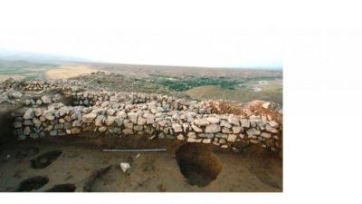
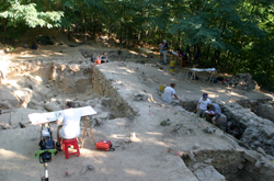
The Saronic Harbors Archaeological Research Project (SHARP), co-directed by Thomas Tartaron (Penn, Classical Studies) and Daniel Pullen (Florida State University), investigates a recently discovered urban Mycenaean harbor site and its larger setting within the Saronic Gulf region. The foundations and walls of more than 50 buildings, some of them monumental, are preserved on the modern surface over 8 hectares. Architectural and artifactual studies allow us to securely date the construction and use of the harbor to the 13th century BCE, the peak of the Mycenaean palatial period. Finds from Kalamianos and other sites discovered in a surface survey covering 7 square kilometers beyond the harbor demonstrate that Kalamianos anchored a significant center of Mycenaean activity, and there is reason to believe that Kalamianos was Mycenae’s main harbor on the Saronic Gulf.
In 1962 under the direction of Froehlich Rainey (Museum Director from 1947-1976), the University Museum undertook a collaborative project with the Lerici Foundation in Rome and the Archaeological Soprintendenza of Reggio Calabria to search for the site of Sybaris, a Greek colony on the Gulf of Tarentum (now Taranto). It was founded in 720 B.C. and destroyed ca. 510 B.C, after which the city of Thurii was reportedly built above the ruins. The Sybaris project developed into a pioneering survey expedition that featured one of the first archaeological uses of magnetometry, a remote sensing technique that measures variations in the magnetic fields of buried structures.
In 1964 Dr. James Pritchard turned his attention to the Jordanian site of Tell es-Sa'idiyeh, identified as the biblical city of Zarethan. The site lies at the heart of the central Jordan Valley, at the intersection of two major trade routes, and was occupied from the early Bronze Age through the seventh century A.D. In two seasons of excavations, Pritchard found a cemetery used in the late Bronze and early Iron Age (ca. 1250-1150 B.C.E.) as well as city remains from the Iron Age (9th-8th century BCE. The rich burials at Tell es-Sa'idiyeh contained bronze vessels, jewelry of gold and precious stones, and imported and locally produced pottery, much of which shows considerable influence from Egypt.
Tell es-Sweyhat, excavated by Prof. Richard Zettler (Associate Curator, Near Eastern Section, University Museum), is a large mounded site located on the left (east) bank of the Euphrates, ca. 65 km. down river from Jerablus (ancient Carchemish) on the Syrian/Turkish border. The Tell es-Sweyhat region plays an important part in subsistence economy today, and probably did also in the past. Tell es-Sweyhat was occupied throughout the third millennium B.C.E., but by the end of that period the site had become a large fortified urban center with a citadel surrounded by an extensive lower town.
The site offers important opportunities for understanding the dynamics of subsistence in marginal environments, the role of pastoralism in the emergence of early state societies, as well as the topography of northern Mesopotamian cities. Though the Tell es-Sweyhat Project has focused to date on the beginning and end of the third millennium, the most recent field seasons, supported by the National Endowment for the Humanities, have revealed fortifications and monumental mudbrick platforms of the early-to-mid third millennium, suggesting that Tell es-Sweyhat was a substantial settlement at the time of Ebla's apogee, and may have been one of the centers, perhaps Burman, mentioned in a well-known letter from the king of Mari to an unnamed contemporary at Ebla.
As for regional work, an intensive geomorphological and archaeological survey was undertaken with the aim of reconstructing long term land use patterns in the Sweyhat embayment. A follow-up regional research program focused on expanding the initial aerial coverage and making topographic maps, systematic surface collections, and soundings (or horizontal exposures) at relevant third and early second millennium sites.
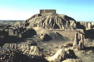
Located in northwestern Iraq near the modern city of Mosul, and not far from ancient Nineveh, Tepe Gawra was excavated by the University Museum from 1931 to 1938. The site was continuously occupied from the Halaf Period (c. 5000–c. 4300 B.C.) to the middle of the 2nd millennium B.C., and gives its name to the Gawra Period (ca. 3500-2900). During the fourth millennium the site appears to have been the ceremonial and administrative center of a small, somewhat peripheral polity in the piedmont of northern Iraq. In varying degrees from level to level, the site's residents also engaged in craft production, including cloth manufacture, pottery making, wood working, bone/stone bead and seal carving, ground stone and lithic tool manufacture, and, perhaps, ran a small, central market place.
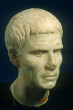
In AD 144-5, at the age of 23, Marcus Aurelius travelled from Rome to the imperial villa at Villa Magna where his adoptive father Antoninus Pius awaited him. In letters to his tutor, Fronto, he described two days spent there, hunting, writing and harvesting the grapes. (Fronto iv. 5). The site of the villa where this rural idyll took place is known today as Villamagna and lies just south of Anagni, some 40 miles south of Rome, at the foot of a steep hill that must be the one referred to in the text. Covering dozens of hectares, the site of the villa today shows little of its former splendour; at the close of the 5-year physical excavation project, 2006-2010, excavated remains mostly had to be backfilled. The excavation was sponsored jointly by the Soprintendenza di Lazio, The Penn Museum, and the British School in Rome; it was directed by Lisa Fentress, with co-directors Sandra Gatti (SBAL) and Andrew Wallace-Hadrill (BSR); Associate Directors were Brian Rose and Ann Kuttner of Penn, with Field Directors Caroline Goodson and Marco Maiuro. Core funding was supplied by the 1984 Foundation, the Comune of Anagni, and the BancAnagni Credito Cooperativo.
The excavation of Villamagna aimed to study its occupation over the longue durée.The lack of deep ploughing guaranteed exceptional preservation of many of the ancient structures, giving a unique opportunity to investigate the architecture and decorative aspects of an imperial villa. Paleobotanical and osteological research threw light both onto the landscapes of the site as well as the economy of the villa and its successor settlements. At outset the remains consisted of three ranges of cisterns fed by an aqueduct which probably leads from a spring at the base of the wooded hill, a nineteenth-century casale built on top of a range of substructures which form the basis villae for a part of the ancient villa, and various traces of substructures on the long ridge running down from the casale towards the road. Halfway along this ridge is a complex of medieval structures, including the church of San Pietro with a Romanesque apse and masonry of much earlier periods, a structure which received attention in the Renaissance and early modern period and some late medieval walls; here, in the early Renaissance period were laid down a large cemetery and burials within the church. The area yielded good traces of Imperial and Late Roman occupation. The monastery that occupied the center of the ridge is particularly interesting for the study of the implantation of monasticism on classical sites, and the development of a small rural monastery from the early middle ages through the fifteenth century. The area by the casale emerged as a distinctive Imperial-era quarter within the estate whose most exceptional feature was fine banquet hall consisting in a wine-press room with sunken dolia and with luxurious opus sectile colored marble flooring and wall revetments (whose remains survived as copious fragments) in a zone largely abandoned by some point in the 3rd c. CE. Down the road from the casale was revealed a utilitarian quarter still in use in the 4th c. CE, whose Imperial-era remains are interpreted as including a slave or servant quarter. Further away down and under fields today geomagnetic prospecting revealed a very large palace complex, yet to be explored.
The result of the project is a full scientific publication by the British School at Rome (in press in 2015), consisting in a volume of analytic essays in conjunction with a dedicated publicly searchable web site housing the full site database.
Site reports are stored at the entry for S. Pietro in Villamagna at FastiOnline (a project of the International Association of Classical Archaeology (AIAC) and the Center for the Study of Ancient Italy (CSAI) of the University of Texas Austin.
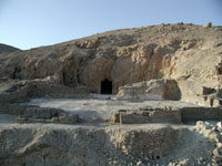
The mountain citadel of Vrokastro overlooks the west-central coast of the broad Gulf of Mirabello in eastern Crete. Vrokastro is an important site in the archaeological record as a defensive or refugee settlement that bridges the end of the Bronze Age and the beginning of the early Iron Age. The site was first inhabited during the Middle Minoan period (ca. 2100 to 1700), then reoccupied at the end of the Bronze Age (ca. 1250 B.C.), and continuously inhabited until the seventh century B.C. In 1910 and 1912, this settlement was excavated for the University Museum by Edith Hall, who uncovered a Middle Minoan and Early Iron Age settlement on the peak and north slope of the 300 m. high mountain. She also excavated cemeteries spanning a period from LM IIIC (ca. 1200 B.C.) through late Geometric (700/650 B.C.).
Although Hall's investigation of the Vrokastro region was a pioneering effort, data derived from her initial investigations of the site were incomplete. Only systematic and intensive survey can provide the necessary framework for analysis, and a new Vrokastro Survey Project was consequently initiated by Dr. Barbara J. Hayden (Senior Research Scientist, Mediterranean Section, University Museum).
The Vrokastro survey is based on a four-part approach involving:
1. an archaeological program (intensive exploration of the landscape supported by pottery analyses)
2. a scientific program (study of the regional botany, soil, geology)
3. an historical program (comprising analysis of ancient sources, regional demographics Venetian and Ottoman archives, and the development of the regional monasteries); and
4. an ethnographic program (comprising the documentation of agricultural practices and crops cultivated, demographics, pastoralism, and the carrying capacity of the land).
The goals of this multidisciplinary project are to place Vrokastro and other regional sites in an historical and environmental context, and to compare the results of this study to data collected from other regional surveys in Crete and the Aegean.