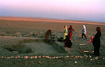
Tell es-Sweyhat, excavated by Prof. Richard Zettler (Associate Curator, Near Eastern Section, University Museum), is a large mounded site located on the left (east) bank of the Euphrates, ca. 65 km. down river from Jerablus (ancient Carchemish) on the Syrian/Turkish border. The Tell es-Sweyhat region plays an important part in subsistence economy today, and probably did also in the past. Tell es-Sweyhat was occupied throughout the third millennium B.C.E., but by the end of that period the site had become a large fortified urban center with a citadel surrounded by an extensive lower town.
The site offers important opportunities for understanding the dynamics of subsistence in marginal environments, the role of pastoralism in the emergence of early state societies, as well as the topography of northern Mesopotamian cities. Though the Tell es-Sweyhat Project has focused to date on the beginning and end of the third millennium, the most recent field seasons, supported by the National Endowment for the Humanities, have revealed fortifications and monumental mudbrick platforms of the early-to-mid third millennium, suggesting that Tell es-Sweyhat was a substantial settlement at the time of Ebla's apogee, and may have been one of the centers, perhaps Burman, mentioned in a well-known letter from the king of Mari to an unnamed contemporary at Ebla.
As for regional work, an intensive geomorphological and archaeological survey was undertaken with the aim of reconstructing long term land use patterns in the Sweyhat embayment. A follow-up regional research program focused on expanding the initial aerial coverage and making topographic maps, systematic surface collections, and soundings (or horizontal exposures) at relevant third and early second millennium sites.
